Lowndes Area Knowledge Exchange (LAKE)

[prev][index][next] [index to photographs]

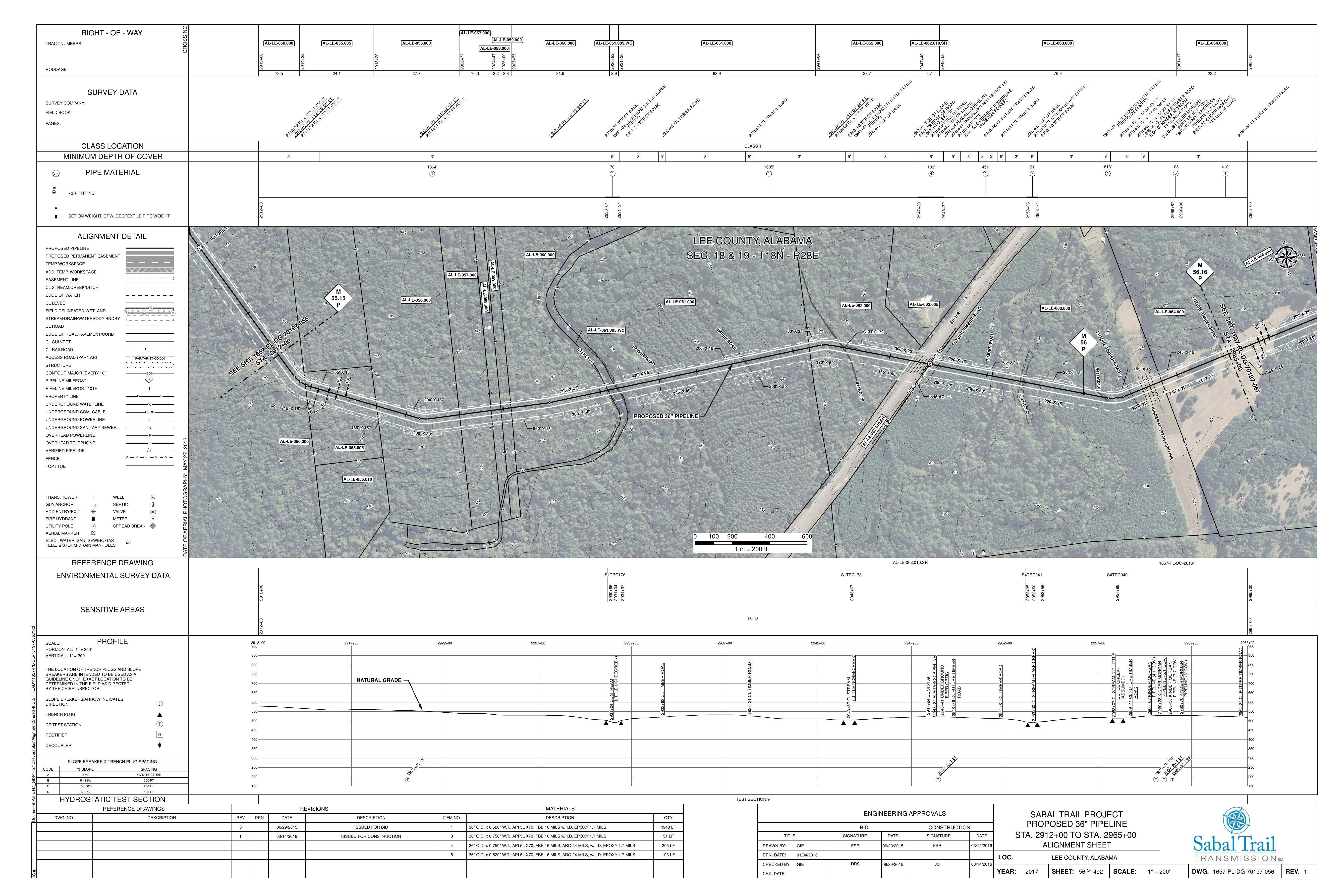
1657-PL-DG-70197-056, STA. 2912+00 TO STA. 2965+00, MP 55.15, MP 56, MP 56.16, PIPELINE (6' COV.), PIPELINE (4.1' COV.), PIPELINE (5.1' COV.), PIPELINE (7.7' COV.), UCHEE CREEK), 2953+50 CL STREAM (FLAKE CREEK), 2948+34 ALAGASCO PIPELINE, 2947+94 CL SR-169, LEE COUNTY, ALABAMA

Lee County, AL
Alignment Maps
7 April 2016
Sabal Trail Transmission lakesubmissions@gmail.com
 
1657-PL-DG-70197-056, STA. 2912+00 TO STA. 2965+00, MP 55.15, MP 56, MP 56.16, PIPELINE (6' COV.), PIPELINE (4.1' COV.), PIPELINE (5.1' COV.), PIPELINE (7.7' COV.), UCHEE CREEK), 2953+50 CL STREAM (FLAKE CREEK), 2948+34 ALAGASCO PIPELINE, 2947+94 CL SR-169, LEE COUNTY, ALABAMA
smaller PDF